
Cedar Canyon Bike Refuges
Ride Cedar Canyon Safely
Cedar Canyon and State Route 14 offer a beautiful, scenic ride through colorful cedar red hills and pine forests. However, the climb is steep, and the road is narrow. There are only a few refuge areas. Simple measures can keep riders safe and drivers aware of cyclists sharing the canyon.
First, get to know the canyon. The route is curvy, with narrow sections, so a driver may not be aware that a cyclist is on the road behind a tight curve. Make note of refuge stations and avoid stopping on the roadway unless you are in one of the refuge areas. Wear bright clothing so drivers can easily see you on the road. Always wear a helmet. Bring clothing that will allow you to adapt to sudden changes in weather.
UDOT recently improved the canyon for all users by widening sections of the road and creating more refuge areas for cyclists.
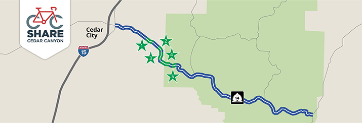
Bike Refuge Locations
1 – MP 5.8 to 6.9
This section of the road has good visibility with open space.
A bike refuge is located on the South side of the road, connected to the Eastbound lane.
2 – MP 8.1 to 8.9
This section of road has a high risk potential due to limited visibility and narrow space with no escape routes for bike traffic caused by the vertical rock face.
A bike refuge with an extended shoulder is located on the South side of the road, connected to the Eastbound lane.
3 – MP 9.3 to 10.4
This section of the road is straight with beautiful scenery with good visibility, but fairly narrow space in the canyon.
A bike refuge with an extended shoulder is located on the South side of the road, connected to the Eastbound lane.
Eastbound paved pull-outs that can accommodate both vehicles and bikers are located at MP 6.0 (Eastbound) and 10.3 (Eastbound).
Westbound paved pull-outs that can accommodate both vehicles and bikers are located at MP 8.9 (Westbound), 9.3 (Westbound) and 10.4 (Westbound).
4 – MP 12.6 to 13.6
Description available when the snow melts
5 – MP 14 to 15.1
Description available when the snow melts
What to Know About Riding Cedar Canyon
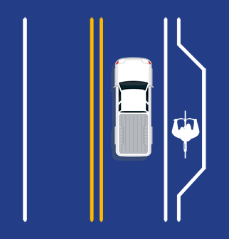
Curvy Roads Ahead
S.R. 14 continues for 40 miles until it intersects with Highway 89 at Long Valley Junction. The route is a steep, winding climb to the top of the Markagunt Plateau, with an elevation gain of 2,760 feet.
This twisty road narrows near the Ashdown Gorge. Cyclists should be courteous to drivers and follow cyclist etiquette. Always be aware of traffic when approaching curves because line of sight is limited.
Traffic Season
May through October is the busiest season for Cedar Canyon, Cedar City is the “Gateway to the National Parks” and S.R. 14 offers a beautiful scenic route for those traveling through the area. Expect heavy traffic, especially on weekends and holidays as the route is popular with tourists.
In May and October, livestock haulers use the canyon from early morning through the afternoon. Cyclists are urged to plan their canyon rides around these peak usage times.
Use the Bike Refuge
Bike refuge locations are now located along the steep incline leading from Cedar City up S.R. 14. Cyclists should use the refuge for emergencies and to allow backed up traffic to pass.
Get more information and become familiar with the refuge locations by visiting UDOT.Utah.gov/ShareCC.